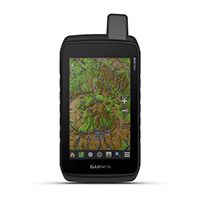
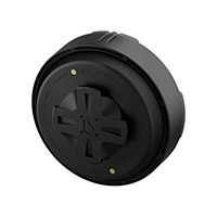
Garmin Tread® 2 Overland Edition Navigator

€ 999,99
- Price without VAT for extra EU countries € 819,66
Shipment in 15 days
Quantity

Write Your Own Review
- Write a review for this product and get a €20 coupon
- Easy return within 30 days
-
Can't find your size?
IS YOUR SIZE NOT AVAILABLE?
-
Need some more information?
Do you want some more information?
-
Did you find a better price?
Best Price Guaranteed
Product information
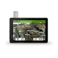
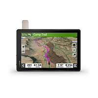
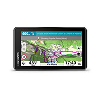
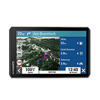
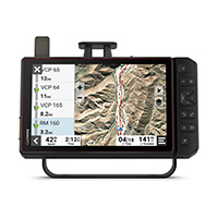
EXPLORE NEW HORIZONS ON YOUR NEXT HIKE
This robust all-terrain satellite navigator will show you the way, guiding you through the most remote and less traveled areas.
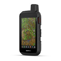
DURABLE IN ANY CONDITION
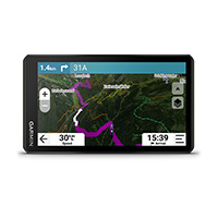
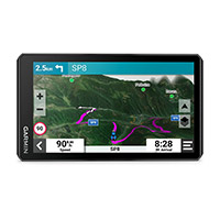
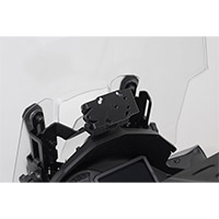
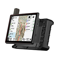
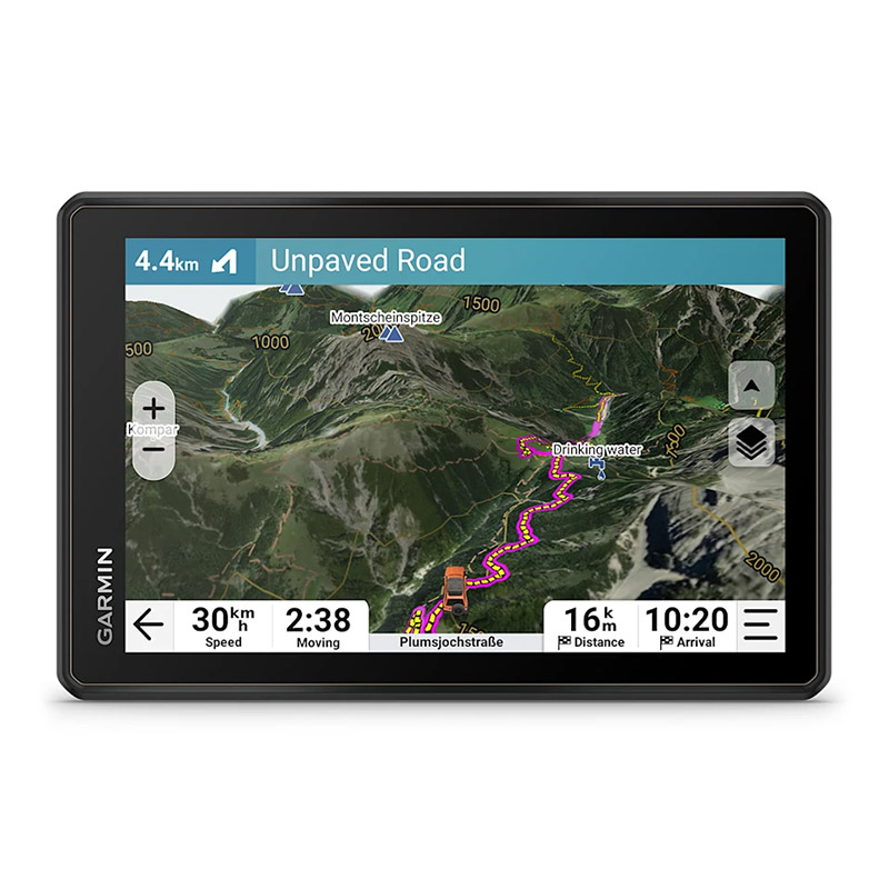
The 8-inch high-resolution touchscreen satellite navigator, ultra-bright and glove-friendly, is designed to withstand extreme temperatures and weather conditions (IP67 waterproof rating). The components provided for vehicle mounting withstand strong vibrations and shocks. The processor also offers improved performance, including faster route calculation and immediate map redrawing.
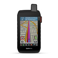
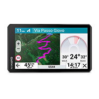
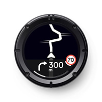
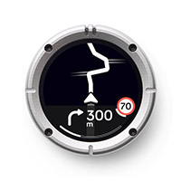
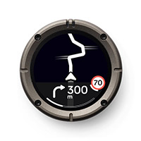
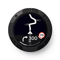
NAVIGATION WITH TURN INDICATIONS
Get detailed navigation on roads and dirt tracks with OpenStreetMap™ and Adventure Roads and Trails2 content for Europe, Africa, and the Middle East.
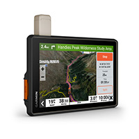
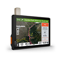
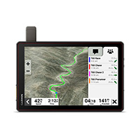
BIRDSEYE IMAGES
Download satellite images directly to your device via Wi-Fi® technology for high-resolution panoramic views of routes and terrain. Free service.
Custom Routes
Standard maps include City Navigator® road maps of Europe, Africa, and the Middle East. In Europe, you get custom road routes based on the size and weight of your vehicle1. Plus, get advance warnings about approaching hairpin turns, level crossings, and more.
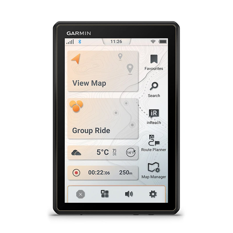
SIMPLIFIED ROUTE PLANNING
Use the Tread smartphone app to easily plan routes, set vehicle profiles and route preferences as they are set on the Tread device. Import and export GPX files to share your favorite routes.
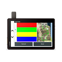
OUTDOOR MAPS+
Purchase an Outdoor Maps+ subscription for full access to a wide range of premium content, including relief shading, built surface maps, light pollution maps, and much more.
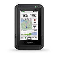
NAVIGATION FEATURES
CAMPSITES
The Tread 2. satellite navigator has a preloaded database of campsites and rest areas provided by ACSI™, Campcontact™, and Trailer's PARK™ to help you find the best places to rest.
GROUP RIDE MOBILE
Check the real-time location of your travel companions via smartphone or compatible Tread device. Both you and your friends need to use the Group Ride Mobile feature.
SYNC
Use the Tread app to easily sync your data, such as waypoints and routes, on your mobile device and the Tread 2 satellite navigator.
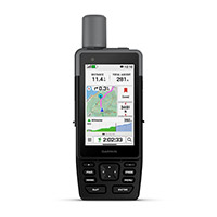
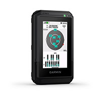
ABC SENSORS
To facilitate orientation in the most difficult situations, you have an altimeter, a barometer, and a compass.
REAL-TIME WEATHER
Want to know the weather conditions you'll find on your route? Pair Tread 2 with your smartphone and download the Tread app for real-time weather, storm alerts, animated radar, and more.
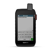
MUSIC FOR YOUR TRIPS
Thanks to the integrated media player, you can easily control the music loaded on your compatible smartphone from the navigator screen and listen to your favorite songs even through a helmet or earphones, if equipped with BLUETOOTH® technology.
COMPATIBILITY WITH OTHER DEVICES
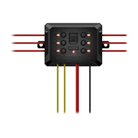
digital box
Control your vehicle's 12V electronic accessories on the screen, including LED bars, sound alerts, ventilation systems, and more, when paired with Garmin PowerSwitch™, a digital switching unit. This feature is not intended for controlling reverse polarity engines.
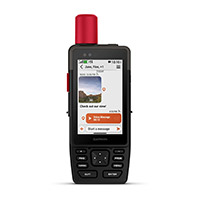
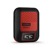
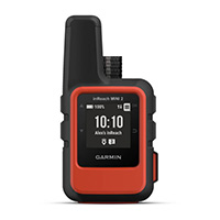
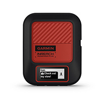
INREACH® TECHNOLOGY
Pair Tread 2 - Overland Edition with your inReach 3 satellite communicator for two-way text messaging, interactive SOS, and weather forecasts. With some devices, you can also send photos and voice messages.
DOG TRACKING
Wirelessly pair the Tread 2 satellite navigator with a compatible Garmin GPS device for dog tracking, to locate your dogs in the field and easily retrieve them at the end of the day. Unless you go out of VHF range, you will see each dog's position on the map.
Group Ride Tracker
Pair your satellite navigator with a compatible Group Ride Tracker (sold separately) for tracking travel companions4 and sending preset messages.
HANDLEBAR CONTROLLER
Get essential map control and keep your hands on the handlebars while driving, by pairing the device with the handlebar controller (sold separately).
This robust all-terrain satellite navigator will show you the way, guiding you through the most remote and less traveled areas.
DURABLE IN ANY CONDITION
The 8-inch high-resolution touchscreen satellite navigator, ultra-bright and glove-friendly, is designed to withstand extreme temperatures and weather conditions (IP67 waterproof rating). The components provided for vehicle mounting withstand strong vibrations and shocks. The processor also offers improved performance, including faster route calculation and immediate map redrawing.
NAVIGATION WITH TURN INDICATIONS
Get detailed navigation on roads and dirt tracks with OpenStreetMap™ and Adventure Roads and Trails2 content for Europe, Africa, and the Middle East.
BIRDSEYE IMAGES
Download satellite images directly to your device via Wi-Fi® technology for high-resolution panoramic views of routes and terrain. Free service.
Custom Routes
Standard maps include City Navigator® road maps of Europe, Africa, and the Middle East. In Europe, you get custom road routes based on the size and weight of your vehicle1. Plus, get advance warnings about approaching hairpin turns, level crossings, and more.
SIMPLIFIED ROUTE PLANNING
Use the Tread smartphone app to easily plan routes, set vehicle profiles and route preferences as they are set on the Tread device. Import and export GPX files to share your favorite routes.
OUTDOOR MAPS+
Purchase an Outdoor Maps+ subscription for full access to a wide range of premium content, including relief shading, built surface maps, light pollution maps, and much more.
NAVIGATION FEATURES
CAMPSITES
The Tread 2. satellite navigator has a preloaded database of campsites and rest areas provided by ACSI™, Campcontact™, and Trailer's PARK™ to help you find the best places to rest.
GROUP RIDE MOBILE
Check the real-time location of your travel companions via smartphone or compatible Tread device. Both you and your friends need to use the Group Ride Mobile feature.
SYNC
Use the Tread app to easily sync your data, such as waypoints and routes, on your mobile device and the Tread 2 satellite navigator.
ABC SENSORS
To facilitate orientation in the most difficult situations, you have an altimeter, a barometer, and a compass.
REAL-TIME WEATHER
Want to know the weather conditions you'll find on your route? Pair Tread 2 with your smartphone and download the Tread app for real-time weather, storm alerts, animated radar, and more.
MUSIC FOR YOUR TRIPS
Thanks to the integrated media player, you can easily control the music loaded on your compatible smartphone from the navigator screen and listen to your favorite songs even through a helmet or earphones, if equipped with BLUETOOTH® technology.
COMPATIBILITY WITH OTHER DEVICES
digital box
Control your vehicle's 12V electronic accessories on the screen, including LED bars, sound alerts, ventilation systems, and more, when paired with Garmin PowerSwitch™, a digital switching unit. This feature is not intended for controlling reverse polarity engines.
INREACH® TECHNOLOGY
Pair Tread 2 - Overland Edition with your inReach 3 satellite communicator for two-way text messaging, interactive SOS, and weather forecasts. With some devices, you can also send photos and voice messages.
DOG TRACKING
Wirelessly pair the Tread 2 satellite navigator with a compatible Garmin GPS device for dog tracking, to locate your dogs in the field and easily retrieve them at the end of the day. Unless you go out of VHF range, you will see each dog's position on the map.
Group Ride Tracker
Pair your satellite navigator with a compatible Group Ride Tracker (sold separately) for tracking travel companions4 and sending preset messages.
HANDLEBAR CONTROLLER
Get essential map control and keep your hands on the handlebars while driving, by pairing the device with the handlebar controller (sold separately).
| SKU | 010-03021-10 |
|---|---|
| ID | 55032 |