Garmin Topoactive Europe


€ 49,99
- Price without VAT for extra EU countries € 40,98
To check availability choose your size
SIZE CHART

Write Your Own Review
- Write a review for this product and get a €20 coupon
- Easy return within 30 days
-
Can't find your size?
IS YOUR SIZE NOT AVAILABLE?
-
Need some more information?
Do you want some more information?
-
Did you find a better price?
Best Price Guaranteed
Product information
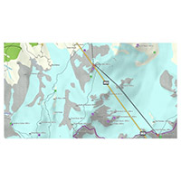
Orienteer and reference any outdoor or recreational activity in 47 European countries with this map, compiled using the community-generated OpenStreetMap (OSM) database.
Includes routable street and off-road networks, international boundaries, waterways, natural features, land use areas, historical sites, airport structures, buildings and more¹
Displays thousands of points of interest, including shops; restaurants and bars; car parks; schools and universities and accommodations
Plan outdoor activities, organize your data and share your adventures with others through our free downloadable trip-planning software, BaseCamp™.
| SKU | 010-D1566-00 |
|---|---|
| ID | 678 |